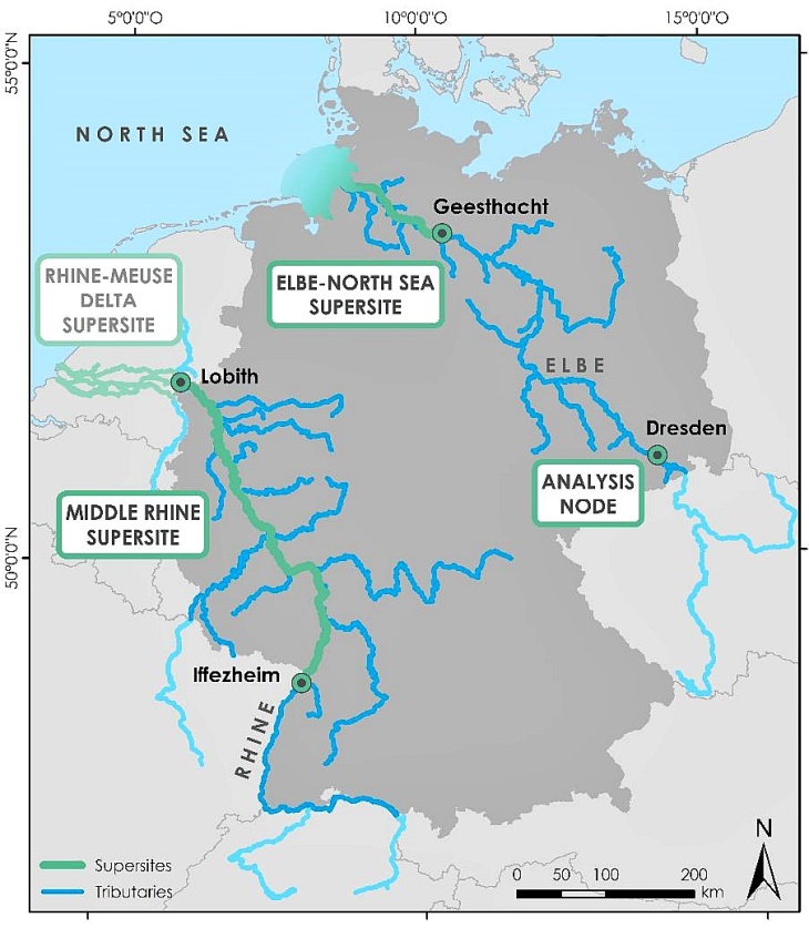
(Map: Federal Waterways Engineering and Research Institute, 2021; References: Federal Waterways and Shipping Administration - Digitale Bundeswasserstraßenkarte 1:1000000 (DBWK1000), 2019; Federal Ministry of Transport and Digital Infrastructure - Karte W170a, 2021)
DANUBIUS-RI is composed of a Hub, Data Centre, Technology Transfer Office, E-Learning Office, Nodes and Supersites across Europe.
Nodes are competence centres, which provide state-of-the-art facilities and equipment, interoperable methods and tools, as well as interdisciplinary expertise regarding observation, analysis, modelling and socio-economic impact studies in River-Sea Systems.
Supersites represent living labs within various River-Sea Systems in Europe, which facilitate case studies along climatic, environmental and socio-economic gradients.
The interplay of these components provides a range of opportunities to study the functioning of River-Sea Systems, to assess impacts and risks from various human activities, as well as to develop and test potential measures addressing the manifold and complex challenges on the way to a sustainable management of River-Sea Systems.
In Germany, the following three components are currently under implementation:
